DLR
EOC
DFD
Terrestrial Hydrosphere
Hydrology
Surface Water
Watershed
Drainage
Basins
Rivers
Streams
Lakes
TanDEM-X
digital elevation model
DEM
opendata
HydroSHEDS v2 is the next generation of global hydrographic data, providing a seamless, high-resolution foundation for mapping and analyzing freshwater systems worldwide. The HydroSHEDS v2 database are a suite of gridded and vector datasets derived from TanDEM-X (TerraSAR-X add-on for Digital Elevation Measurement) elevation data.
DLR processed the original 12 m resolution TanDEM-X data to create a hydrologically pre-conditioned DEM that was further refined by hydrological optimisation and correction algorithms by Confluvio Consulting Inc., Montreal, Que., Canada, to derive drainage pathways. The resulting HydroSHEDS v2 database will provide river networks and catchment boundaries at full global coverage. See https://www.hydrosheds.org/hydrosheds-v2 for more information.
The core data products of HydroSHEDS v2 are freely available and are provided at a resolution of 1 arc-second (~30 meters at the equator):
- Flow Directions (DIR): A drainage direction map derived from the conditioned elevation data - Flow Accumulation (ACC): A flow accumulation map derived from the flow direction map, representing the number of upstream grid cells
- River network (RIV): A river network derived from the flow direction map, using a minimum upstream catchment threshold of 1 square kilometers
- HydroBASINS (BAS): A beta version of drainage basins (HydroBASINS) as a companion layer for the river reaches. The data is currently limited to the Americas. Additional regions will be made available in future releases.
References:
- Lehner, B., A. Roth, M. Huber, M. Anand, and M. Thieme (2022), A sharper look at the world’s rivers and catchments, Eos, 103 DOI: 10.1029/2022EO220167
Items:
The Flow Directions raster represents the drainage directions as a raster file, containing eight values of possible directions in which water can flow from pixel to pixel.
The flow accumulation raster provides the count of upstream pixels that drain into each cell.
The River Network represents the river network generated from the flow directions, as well as corresponding node points.
The HydroBASINS layer represents a polygon layer that depicts sub-basin boundaries.
Related Datasets:
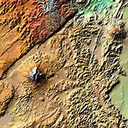
TanDEM-X 90m DEM
2023-11-15
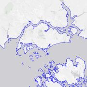
TanDEM-X High-Resolution Coastline
2026-01-20